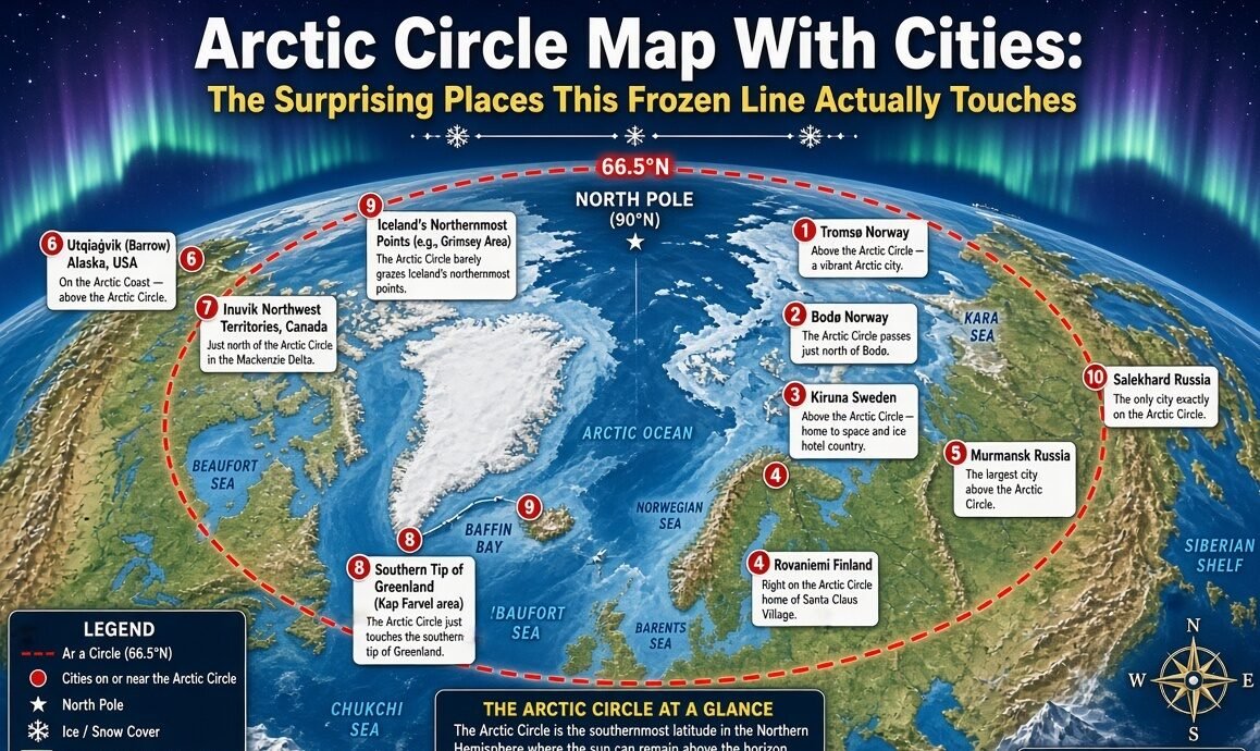
Arctic Circle map with cities is suddenly getting more attention as travelers, map lovers, and curious readers look closer at the strange line running around the far north. Today, Friday, August 21, 2026, I looked at the map and found something quite surprising. The line does not simply cross empty snow, because real towns and busy cities live close to it too.
I always thought the Arctic Circle was mostly ice and white land. Then I followed the line on a map, and the picture became much more interesting. It runs through parts of Norway, Sweden, Finland and Russia, while continuing across the Arctic Ocean and reaching North America and Greenland. Some famous northern cities sit well above it, while others are very close but technically below the line.
The Arctic Circle is an imaginary circle around Earth. It sits at roughly 66°34′ north latitude, although its exact position changes slightly over time. That small fact can make maps look different from one another. The line marks an important solar boundary, too. North of it, there can be at least one day each year when the Sun does not set, and at least one day when it does not rise.
When I picture the Arctic Circle map, I imagine a huge ring wrapped around the top of the planet. But the real map is not as simple as a clean circle. Mountains, islands, seas, forests, tundra and cities all appear around this northern world. The line passes through different landscapes, and every country gives the Arctic a slightly different face.
One of the most famous places connected with the line is Rovaniemi in Finland. The city itself is close to the Arctic Circle, while the famous Santa Claus Village is located directly on the marked line. Visitors can stand with one foot on each side and take a photograph. It sounds like a small thing, but it has turned a mathematical line into a major travel attraction.
I find Rovaniemi especially interesting because it does not look like the lonely Arctic picture many people imagine. There are roads, hotels, shops, homes, restaurants and an airport. The surrounding Lapland landscape still feels wild, though. Winter brings snow and long darkness, while summer can bring the Midnight Sun.
The map gets even more dramatic when it reaches Russia. Murmansk stands out immediately. It is one of the largest cities north of the Arctic Circle and is an important port on the Kola Peninsula. Unlike the simple image of a frozen harbor, Murmansk has access to waters influenced by warm Atlantic currents, helping keep the nearby sea relatively ice-free.
That is one of the things I love about maps. A tiny line can hide a huge story. Looking at Murmansk, I can see that the Arctic is not one giant frozen desert. People live, work, travel and build industries there. The city also shows why northern geography matters for transport and the wider Arctic region.
Another name that makes the map exciting is Salekhard. It is in Russia and is widely described as the only city located directly on the Arctic Circle. That makes it a special point on almost any Arctic map with cities. The line does not merely pass somewhere near it. The city has become strongly connected with the geographic boundary itself.
Then there is Kiruna in Sweden. It lies far north in Swedish Lapland and is one of the best-known Arctic communities. Kiruna is famous for its mining history, but the surrounding region is also known for snowy landscapes and northern lights. When I look at its position on a map, it becomes clear how far north the city really is.
Jokkmokk is another Swedish name that appears in Arctic travel and geography stories. It has a strong connection with Sámi culture and the northern environment. The town sits in a region where the Arctic Circle is not just a line on paper. It is part of everyday geography.
Norway gives the map another personality. Places such as Tromsø and Alta are well north of the Arctic Circle and are major northern destinations. Tromsø, in particular, has become famous among visitors chasing the Northern Lights. The city also has a university, cultural life and modern services, proving again that Arctic living can be surprisingly urban.
Bodø is another important northern Norwegian city, although its position relative to the Arctic Circle needs care. Parts of the region sit around the circle, but the city itself is generally treated as just south of the line. This is why a detailed map is better than simply calling every northern city an Arctic Circle city.
The same problem appears with Fairbanks in Alaska. People often connect Fairbanks with the Arctic because of its northern position and strong aurora tourism. But the city itself is south of the Arctic Circle. A map makes that difference very clear.
Utqiaġvik, Alaska, formerly known as Barrow, is much farther north. It is one of the largest communities in the United States north of the Arctic Circle. Life there is shaped strongly by the polar environment, with long periods of unusual daylight and darkness. The town looks very different from cities farther south, yet it is still a functioning community with homes, schools, businesses and local traditions.
Canada also has important Arctic communities. Inuvik in the Northwest Territories is one of the better-known settlements in the Canadian Arctic. Iqaluit, the capital of Nunavut, is another major northern city, although it is not directly on the Arctic Circle. Its location shows why the word “Arctic” is broader than the geographic line itself.
Greenland makes the map feel even bigger. The island is mostly covered by a huge ice sheet, yet communities are spread along its coasts. Sisimiut is one of the largest communities north of the Arctic Circle. Nuuk, Greenland’s capital, is farther south of the line, showing again that an Arctic map contains both places north of the circle and places commonly associated with the wider Arctic region.
I also noticed something important when checking different maps. Not every map uses the same definition of an “Arctic city.” Some maps show only cities north of 66°34′N. Others include major settlements that are just south of the line but are culturally, economically or climatically connected to the Arctic.
That difference can create confusion online. A headline may call a city an Arctic Circle city when it is actually several kilometres south of the geographic boundary. Rovaniemi is a perfect example. The famous Arctic Circle attraction is north of the city centre, while the city itself sits just south of the line.
The map also tells a story about human settlement. Russia contains many of the largest urban communities in the far north. Murmansk, Norilsk and Vorkuta are examples of cities that developed in extremely challenging environments. Norway and Sweden also have established northern communities, while Alaska, Canada and Greenland have smaller populations spread across huge distances.
Norilsk is particularly striking. It lies deep inside northern Russia and is famous for its severe climate and industrial importance. It is not sitting directly on the Arctic Circle, but it is far beyond the line. The city shows that people can build major industrial centres even in places where winter conditions are extremely hard.
The Arctic Circle map is also a climate map in disguise. The closer I look, the more I see connections between geography and daily life. Winter darkness affects travel and work. Snow changes roads. Sea ice affects shipping. Permafrost can affect buildings. Wildlife follows seasonal patterns. And sunlight itself becomes a major part of the calendar.
In summer, the story flips. The Midnight Sun can keep the sky bright for long periods north of the circle. In winter, the Polar Night creates the opposite experience. The exact duration increases toward the North Pole. Murmansk, for example, experiences a long period around winter when the Sun stays below the horizon.
That makes the Arctic Circle more than a simple geographic marker. It is also a line connected with one of Earth’s strangest natural experiences. Two cities at similar longitudes can have very different daily conditions depending on their latitude, elevation, coast and local climate.
I think this is why an Arctic Circle map with cities can be more useful than a plain Arctic map. A normal map may show countries, oceans and ice. A city map adds people. Suddenly the viewer can understand where communities actually exist inside this extreme landscape.
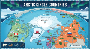
The route of the Arctic Circle itself is also fascinating. It crosses Norway, Sweden, Finland and Russia before continuing across the Arctic Ocean. It then reaches regions associated with Alaska, Canada and Greenland. Iceland is sometimes included in discussions of Arctic geography because the circle comes close to or touches its northern island territory, depending on the geographic definition and exact line position.
For travelers, the Finnish section is probably the easiest place to experience the famous boundary in a simple way. At Santa Claus Village near Rovaniemi, the Arctic Circle is physically marked. Visitors can cross it on foot, take pictures and explore the surrounding attractions.
But I would not stop the story at tourism. The people living north of the line have much more complicated stories. Indigenous communities, scientists, workers, families and travelers all share the northern environment. Sámi communities, for example, have deep cultural connections across northern Norway, Sweden, Finland and Russia.
Modern Arctic maps also reveal economic activity. Roads, railways, ports, mines and transport routes connect some remote settlements with the rest of the world. A recent Arctic regional map from the Arctic Centre shows population centres, transport routes, mines and other major features across the Barents region.
The Arctic is changing, too. Climate change is reshaping sea ice, ecosystems and northern infrastructure. That means an Arctic map made today may not tell exactly the same environmental story as one made decades ago. The geographic circle remains a useful latitude line, but the landscape around it is changing.
I keep coming back to the cities because they make this huge region easier to understand. Murmansk gives the Russian Arctic a human face. Rovaniemi connects geography with tourism. Kiruna links the Arctic with mining and Swedish Lapland. Tromsø shows that northern cities can be lively and modern. Utqiaġvik shows what life looks like much farther north in Alaska.
There is also something slightly funny about the whole idea. We draw one thin line around Earth and give it a huge name, yet the world does not suddenly become frozen the moment that line is crossed. Nature changes gradually. The line is important for sunlight geometry, but real weather and landscapes do not obey a perfectly sharp border.
So, when I look at an Arctic Circle map with cities, I no longer see only a cold ring around the planet. I see airports, ports, homes, roads, mines, forests, tundra, fjords and people. I see a region that looks empty from far away but is surprisingly active up close.
The biggest surprise may be that some famous “Arctic cities” are not actually sitting on the Arctic Circle at all. Some are north of it. Some are south of it. One of the clearest examples is Salekhard, which is directly associated with the line, while Rovaniemi is famous because the marked Arctic Circle passes near the city and through its Santa Claus Village area.
And that is why the map matters. It corrects the picture in my head. It replaces a simple white world with something far richer. The Arctic Circle is a mathematical boundary, but around that boundary is a living world.
For anyone planning a northern trip, studying geography, writing about Arctic news or simply wondering where the far north really begins, the city map gives a powerful starting point. Follow the line from Scandinavia into Russia, then across the polar ocean toward North America and Greenland, and suddenly the Arctic feels less distant.
I started with a simple map. I ended with a much bigger story. The Arctic Circle is not just a line around the top of Earth. It is a meeting point of sunlight, climate, geography, culture and human life. And once the cities are added, the frozen north suddenly feels much closer.
✍️ Written by Vimal Bhagat
🌎 Sharing fresh news, trending stories & interesting updates from around the world.
💙 Read more: arcticcircle.us